Our Capabilities
Our expertise spans the full lifecycle of remote sensing and imaging systems—we support the design and optimization of remote sensing and imaging systems with data-driven precision and domain expertise to unlock actionable intelligence in mission-critical applications.
Engineering
Environmental
Consulting
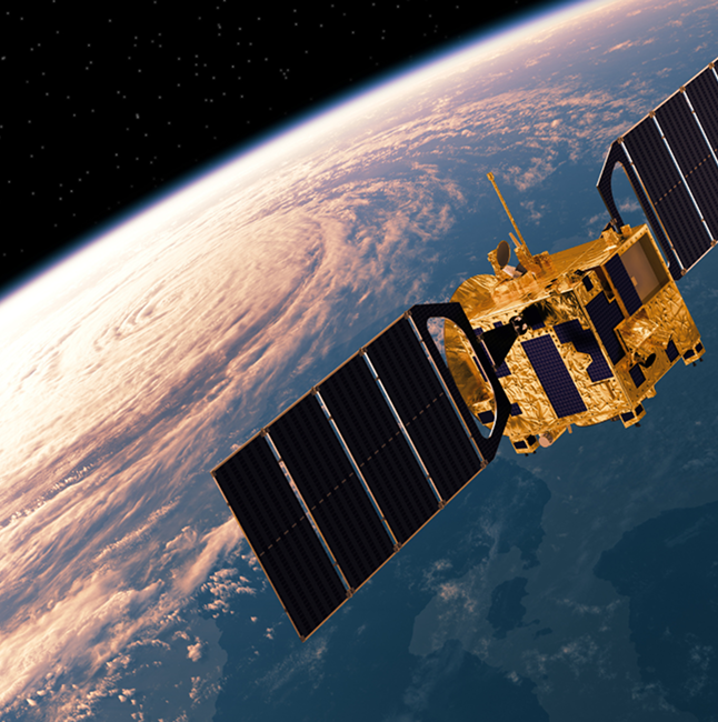
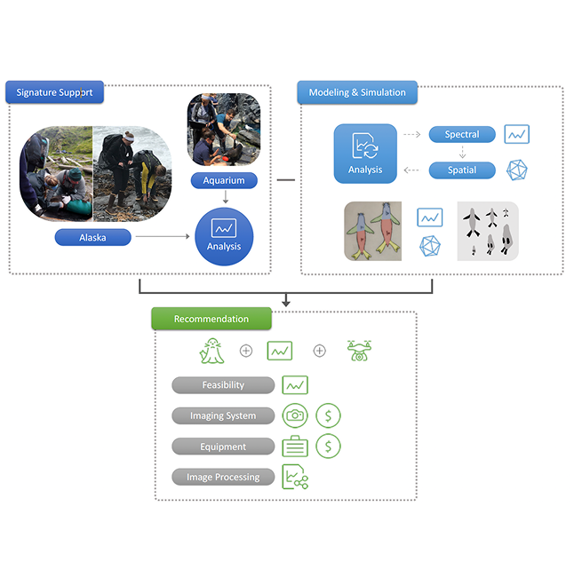
EO/IR Radiometric Calibration & Validation
We provide end-to-end radiometric calibration and validation services for EO/IR systems, trusted by NASA and NOAA. From pre-launch characterization to post-launch analysis, we ensure your data meets rigorous uncertainty and performance standards for mission-critical applications.
- Pre- and Post-launch characterization, calibration, and validation
- Airborne and satellite-based system support
- Sensor performance benchmarking and trade studies
- Coordination & planning bridging engineering with end-users
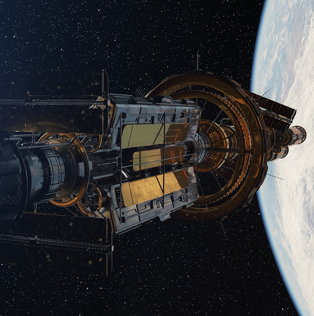
Integrated Space Systems Engineering
Our team delivers deep technical systems engineering support for complex space-based platforms. We specialize in end-to-end system performance assessments, Cal/Val, quality assurance, CONOP development, and science traceability across Earth observation and environmental missions.
- Readiness for Cal/Val post-launch testing
- Science Traceability Development
- Payload integration and validation
- NASA and NOAA satellite mission experience

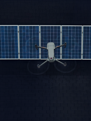
Airborne Systems Integration (Manned & UAS)
We provide remote sensing strategy and concept design, sensor integration support, and field validation for airborne platforms ranging from high-altitude manned aircraft to small UAS. Our expertise includes end-to-end technical and project management support to ensure successful airborne science missions.
- Mission concept design and requirements definition
- Sensor payload selection integration support
- Flight testing, performance optimization, and mission execution
- Extensive experience with NOAA and NASA airborne platforms
Image Chain Analysis
Our image chain analysis evaluates the full path of sensor data—from photon collection to final imagery. We model and assess performance at every stage to ensure your systems deliver reliable, actionable data in real-world scenarios.
- End-to-end imaging system modeling and simulation
- System performance assessments, image quality, and trade studies
- Data Formatting and assurance
- Support for R&D and operational systems
System Design & Performance Characterization
We help clients architect advanced remote sensing systems and measure their performance in real-world environments. Our approach blends modeling, lab testing, and field validation to align design with mission objectives.
- Requirements definition and review
- Custom performance modeling and validation
- CONOP development
- Applied experience from concept to launch
Modeling & Simulation
Our modeling and simulation capabilities allow clients to test, refine, and optimize complex systems before field deployment. We simulate mission scenarios, sensor behaviors, and data outputs to inform decisions and reduce risk.
- Physics-based sensor and system modeling
- Assessment and system performance in critical applications
- Trade studies and design iteration support
- Support for airborne, spaceborne, and ground systems
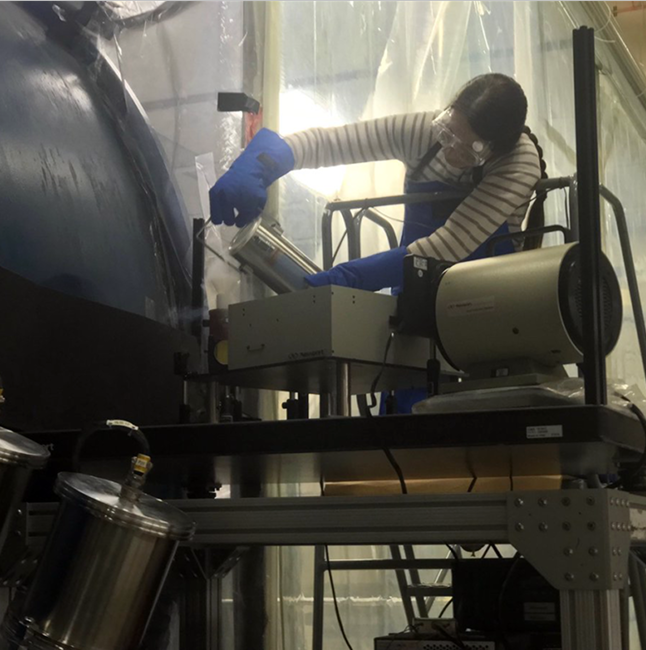
Instrument Science
We provide extensive instrument science support on the research, development, and testing of cutting-edge remote sensing instruments. Our support spans the entire process, from initial conceptual design and requirements definition, component level testing, integration and characterization & cal/val, and instrument operations.
- Instrument performance modeling
- Support instrument & component level testing
- Pre-launch radiometric testing support
- Requirements compliance & trade studies
System Optimization
We improve system performance through design refinement, data feedback loops, and operational calibration. Whether improving SNR, reducing distortion, or streamlining architecture, we help clients get the most from their platforms.
- Verify cal/val test analysis and system performance specifications
- Routine & deep‑dive post-launch monitoring and trending analytics
- Developed and implemented state-of-the-art post-launch Cal/Val methods and analysis to ensure data quality
- Led mission‑level data reprocessing for long‑term science and AI ready data records
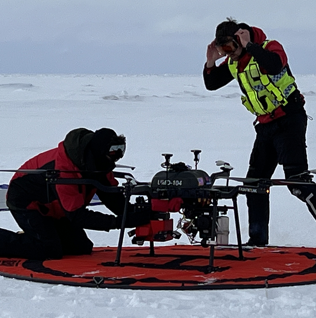
Feasibility Demonstration
We evaluate the viability of new systems or technologies through rapid prototyping and field testing. From UAS-mounted sensors to integrated payloads, we help clients validate their concepts in real-world conditions.
- Technology readiness assessments
- Prototyping and proof-of-concept builds
- Field trials and data collection support
- NASA/NOAA project experience
Mission Planning & Execution
We support all phases of remote sensing mission planning—from early concept development to in-field execution. Our services include logistics coordination, payload prep, flight planning, and live ops support.
- Flight and data collection planning
- Ground support coordination
- In-field ops and troubleshooting
- Full-cycle support from pre-launch to mission closeout
Data Collection & Analysis
We provide scientific data collection and processing services, including sensor operation, data calibration, and post-collection analytics. We extract actionable insights and ensure data meets quality standards for your mission.
- UAS and airborne data acquisition
- Onboard and remote data validation
- AI-enhanced analysis workflows
- NOAA and NASA research support
System-of-Systems Architecture
We specialize in integrating complex subsystems into cohesive architectures that meet mission-wide objectives. Our approach ensures data flow, interoperability, and scalability across platforms and components.
- Architecture definition and documentation
- Integration across sensing, communication, and processing systems
- Risk reduction and configuration control
- Experienced in multi-platform coordination

AWS Cloud Computing for Remote Sensing Workflows
We design and deploy AWS-based architectures for processing, storing, and analyzing geospatial data at scale. Our solutions support AI/ML workflows, large-scale environmental data handling, and operational efficiency.
- Cloud-native geospatial pipelines
- AI/ML-ready environments
- Scalable storage and processing solutions
- Expertise in remote sensing data migration to the cloud
Cloud-Based Solutions
We deliver custom, cloud-enabled platforms that integrate data, analytics, and visualization for decision-making at scale. These solutions are built to be flexible, secure, and fast.
- Design and deployment of cloud-based dashboards
- Integration of geospatial and environmental data feeds
- User-friendly UX for technical and non-technical users
- Custom APIs and backend automation
How It Works
At GeoThinkTank, we blend deep technical expertise with strategic execution to deliver innovative solutions—from system design to mission-ready performance. Here’s how we bring your vision to life.
01.
Discovery & Requirements
We begin by understanding your mission objectives, system needs, and data challenges. Through collaborative discussions and technical assessments, we align on a clear scope and success criteria.
02.
System Design & Modeling
Our team develops custom architectures using advanced modeling and simulation techniques. Whether it’s EO/IR payloads or UAS platforms, we ensure systems are optimized for real-world performance and mission goals.
03.
Integration & Field Testing
From component-level integration to full system validation, we manage the end-to-end buildout. We conduct rigorous field testing and calibration—often in collaboration with agencies like NASA and NOAA—to ensure accuracy and reliability.
04.
Data Analysis & Optimization
After deployment, we analyze performance metrics and environmental data to refine and optimize system outputs. Our insights inform continuous improvement, mission planning, and long-term system resilience.
01.
Identify the Data Need
We start by understanding the specific environmental questions or operational challenges you’re facing—whether it’s for fieldwork planning, risk mitigation, or real-time decision support. This ensures our solutions are purpose-built for your mission.
02.
Configure Data Pipelines
Using our custom-built geospatial data engine, we design AI/ML-powered pipelines that pull from trusted weather, oceanic, and environmental data sources. These pipelines are tailored to your region, use case, and delivery preferences.
03.
Actionable Insights
We transform raw data into intuitive visualizations, alerts, or predictive models—delivered in the format that works best for your team. Whether mobile, dashboard, or API-driven, you get real-time intel when it matters most.
04.
Refine & Evolve
As conditions and priorities shift, we iterate. Our system continuously adapts through feedback loops, user behavior, and model performance to keep insights relevant, accurate, and impactful.
01.
Strategic Intake & Assessment
We begin with a focused consultation to understand your goals, challenges, and current systems. Whether you’re launching a new mission or optimizing an existing program, we align our approach with your priorities.
02.
Expert-Led Solution Design
Our team applies deep subject matter expertise across imaging science, systems engineering, and geospatial analysis to craft tailored solutions. We combine technical precision with strategic foresight to solve complex problems efficiently.
03.
Implementation & Support
From high-level strategy to hands-on execution, we support integration, testing, and project management every step of the way. We become an extension of your team, delivering with the same level of ownership and urgency.
04.
Insight & Optimization
We don’t just deliver reports—we provide actionable insights that evolve with your mission. Our ongoing support ensures sustained performance, informed decision-making, and long-term success.
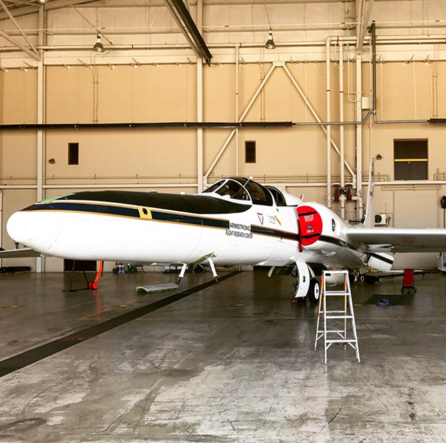
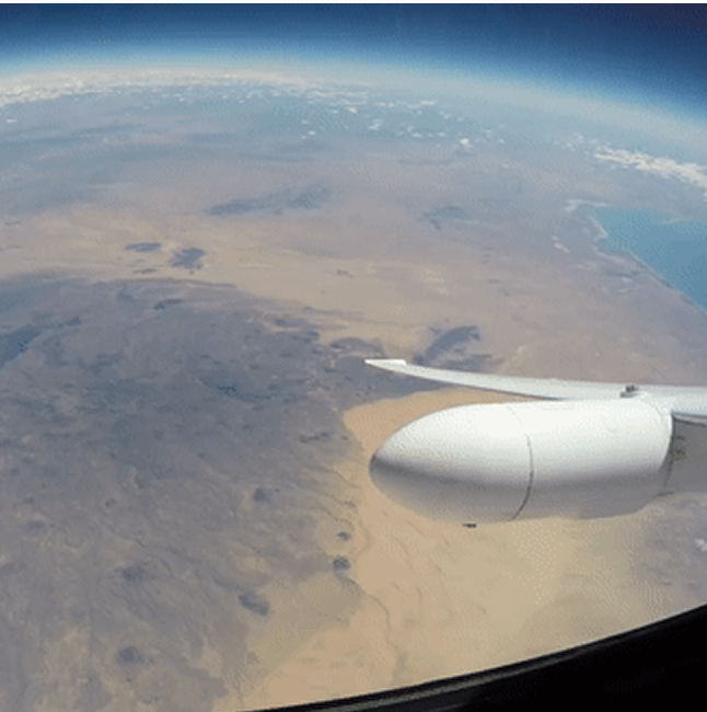
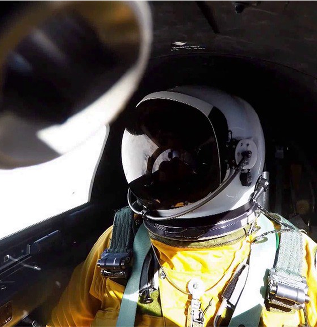
Validating Satellites From The Stratosphere
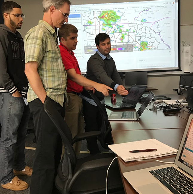
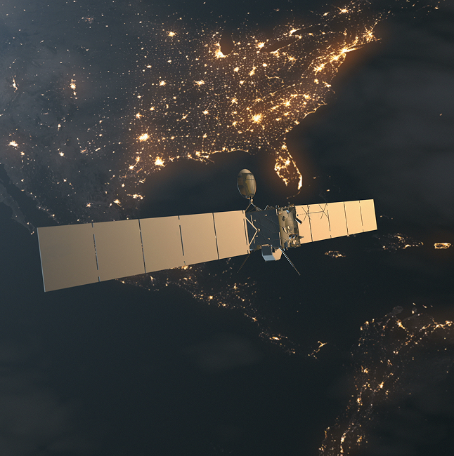
GeoThinkTank supported a critical airborne science campaign aimed at validating the performance of next-generation satellite instruments, including the Advanced Baseline Imager (ABI) and Geostationary Lightning Mapper (GLM). In our role as Project Manager and technical support we were responsible for coordinating a diverse team of government, industry, academic, and international partners to ensure mission success, while also providing extensive subject matter technical expertise. The team successfully achieved independent validation of the satellite data using highly specialized high-altitude aircraft campaigns integrated with a host of well-characterized reference sensors. This allowed for precise alignment between airborne and satellite perspectives—improving confidence in environmental data that is relied upon for everyday weather forecasting, tracking hurricanes, monitoring the Earth’s atmosphere, and aiding commerce throughout the western hemisphere.
AI Speaker For
Real-World Innovation
We bring real-world AI insights to everyday innovation.
Engineering FAQs
Explore common questions about our engineering services, processes, and capabilities.
What Types Of Remote Sensing Systems Do You Support?
We work across a range of platforms, including spaceborne, airborne (manned and UAS), and ground-based systems. Our expertise spans EO/IR sensors, calibration payloads, and integrated mission architectures.
Can You Support Pre-Launch And Post-Launch
Calibration Efforts?
Yes. We specialize in both phases—providing sensor characterization, radiometric calibration, and performance validation during development, launch, and operational phases.
How Do You Approach System Integration For Airborne Platforms?
We handle the full integration process—from payload selection and mounting to flight planning, calibration, and in-field testing. Our experience includes both high-altitude manned aircraft and small UAS deployments.
Do You Offer Modeling And Simulation Before System Deployment?
Absolutely. We use physics-based modeling and mission simulation to evaluate design choices, system performance, and mission feasibility before hardware hits the field.
Can You Support Cloud-Based Processing For Geospatial Data?
Yes. We architect and deploy AWS-based pipelines for scalable remote sensing data processing, including AI/ML applications and large environmental datasets.
01. This is a frequently asked question?
Lorem ipsum dolor sit amet, consectetur adipiscing elit. Suspendisse varius enim in eros elementum tristique. Duis cursus, mi quis viverra ornare, eros dolor interdum nulla, ut commodo diam libero vitae erat.
02. This is a frequently asked question?
Lorem ipsum dolor sit amet, consectetur adipiscing elit. Suspendisse varius enim in eros elementum tristique. Duis cursus, mi quis viverra ornare, eros dolor interdum nulla, ut commodo diam libero vitae erat.
03. This is a frequently asked question?
Lorem ipsum dolor sit amet, consectetur adipiscing elit. Suspendisse varius enim in eros elementum tristique. Duis cursus, mi quis viverra ornare, eros dolor interdum nulla, ut commodo diam libero vitae erat.
04. This is a frequently asked question?
Lorem ipsum dolor sit amet, consectetur adipiscing elit. Suspendisse varius enim in eros elementum tristique. Duis cursus, mi quis viverra ornare, eros dolor interdum nulla, ut commodo diam libero vitae erat.
05. This is a frequently asked question?
Lorem ipsum dolor sit amet, consectetur adipiscing elit. Suspendisse varius enim in eros elementum tristique. Duis cursus, mi quis viverra ornare, eros dolor interdum nulla, ut commodo diam libero vitae erat.
Custom Environmental Data Engines
We build tailored environmental data engines that deliver fast, reliable access to the data your team needs. These systems are designed to support decision-making in dynamic conditions—built with flexibility, scalability, and usability in mind.
- On-demand access to weather and environmental data
- Custom pipeline development for government and commercial users
- Built to support real-time applications and analytics
- Scalable for regional or global data needs
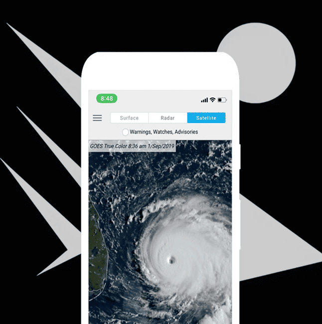
Comprehensive Land, Ocean, Atmosphere & Weather Data Platforms
We develop platforms that provide seamless access to weather, marine, and environmental datasets. Designed for outdoor industries, environmental researchers, and mission planners, our tools bring clarity and speed to critical decisions.
- Aggregation of trusted weather and ocean data sources
- User-friendly interfaces or API delivery
- Mobile or cloud-based integration
- Supports safety, planning, and risk mitigation

Predictive Modeling (AI/ML-Driven)
AI/ML driven R&D models turn raw environmental data into actionable forecasts and trend insights. Whether it’s predicting weather shifts or optimizing mission readiness, our models find answers with real world utility and business value.
- Custom AI/ML model development
- Time-series and environmental pattern recognition
- Support for operational forecasting and alert systems
- Continuous model refinement based on feedback loops
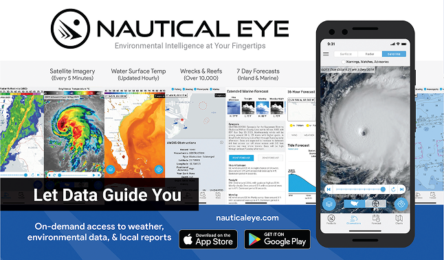
Development of Nautical Eye (Sunset Product)
Our experience building Nautical Eye—an environmental intelligence app with over 100,000 downloads—demonstrates our capacity for full-cycle product development. From concept and data pipeline design to mobile UX and app store optimization, we created a product that served boaters, anglers, and outdoor users nationwide.
- 100K+ downloads and top 25 ranking in Apple’s Weather category
- End-to-end design and data engine development
- Real-time marine and weather data delivery
- Demonstrated commercial product operations experience

Upcoming Product: EnvIntel.com
EnvIntel.com is our next-generation environmental intelligence platform—an AI-powered system built to deliver predictive weather and ocean insights. Designed for commercial and government use, EnvIntel will help users make faster, more informed decisions through smart alerts, visualizations, and data tools.
- AI/ML-driven predictive environmental insights
- Built on custom data pipelines
- Supports operations, safety, and mission planning
- Coming soon

EnvIntel.Com - Environmental Intelligence API (Coming Soon!)
The EnvIntel API is our flagship backend for on-demand environmental intelligence. Built on AI/ML models, it delivers instant access to weather forecasts, risk scores, and domain-specific environmental metrics.
- High-performance, cloud-hosted API architecture
- Customizable endpoints for diverse applications
- Real-time analytics and alerts integration
- Designed for commercial and government interoperability
Environmental Intelligence For Government and Commercial Use
We translate complex environmental data into strategic intelligence for both public and private sectors. From real-time dashboards to long-term modeling tools, we build solutions that bridge science, policy, and operations.
- Government-grade environmental data platforms
- Commercial solutions for outdoor, marine, and logistics industries
- Trusted by NOAA, Fisheries, and more
- Customizable to tailor to your mission


Custom Data Engines (Multi-Domain Environmental and Energy Market)
We are developing custom data platforms tailored to the needs of environmental and energy market stakeholders. These systems offer seamless integration of large, diverse datasets into dynamic, actionable insights.
- Cross-domain environmental and energy dataset fusion
- Scalable analytics infrastructure
- Forecasting and modeling capabilities with AI/ML
- Support for regulatory and operational applications
Data Access Platforms
We build secure, user-friendly platforms that provide direct access to curated environmental datasets. These tools are designed to support real-time insight, user customization, and integration with external systems.
- Unified portal for multi-source data streams
- Permissions-based access control
- API-ready data formatting and export tools
- Live visualizations and alert capabilities


Data Engineering And Predictive Modeling (AI/ML-Driven)
We transform raw environmental data into usable intelligence through robust data engineering and advanced machine learning. Our team builds scalable pipelines and models that serve real-world applications.
- Scalable ingestion and preprocessing architecture
- AI/ML model training, validation, and tuning
- Data cleaning and quality assurance workflows
- Integration with operational decision support systems
SnapIntel.Com - Instant Alert System (Coming Soon!)
SnapIntel delivers real-time environmental alerts powered by AI. Designed for users in fast-paced, high-stakes environments, it enables quick responses to critical changes in weather, ocean, or environmental risk.
- Instant push notifications based on smart triggers
- Configurable delivery methods (SMS, app, dashboard)
- AI-enhanced filtering for accuracy and relevance
- Field-ready for emergency response and planning

SnapIntel.com – Instant Alert System
SnapIntel delivers real-time environmental alerts powered by AI. Designed for users in fast-paced, high-stakes environments, it enables quick responses to critical changes in weather, ocean, or environmental risk.
- Instant push notifications based on smart triggers
- Configurable delivery methods (SMS, app, dashboard)
- AI-enhanced filtering for accuracy and relevance
- Field-ready for emergency response and planning

How It Works
At GeoThinkTank, we blend deep technical expertise with strategic execution to deliver innovative solutions—from system design to mission-ready performance. Here’s how we bring your vision to life.
01.
Discovery & Requirements
We begin by understanding your mission objectives, system needs, and data challenges. Through collaborative discussions and technical assessments, we align on a clear scope and success criteria.
02.
System Design & Modeling
Our team develops custom architectures using advanced modeling and simulation techniques. Whether it’s EO/IR payloads or UAS platforms, we ensure systems are optimized for real-world performance and mission goals.
03.
Integration & Field Testing
From component-level integration to full system validation, we manage the end-to-end buildout. We conduct rigorous field testing and calibration—often in collaboration with agencies like NASA and NOAA—to ensure accuracy and reliability.
04.
Data Analysis & Optimization
After deployment, we analyze performance metrics and environmental data to refine and optimize system outputs. Our insights inform continuous improvement, mission planning, and long-term system resilience.
01.
Identify the Data Need
We start by understanding the specific environmental questions or operational challenges you’re facing—whether it’s for fieldwork planning, risk mitigation, or real-time decision support. This ensures our solutions are purpose-built for your mission.
02.
Configure Data Pipelines
Using our custom-built geospatial data engine, we design AI/ML-powered pipelines that pull from trusted weather, oceanic, and environmental data sources. These pipelines are tailored to your region, use case, and delivery preferences.
03.
Actionable Insights
We transform raw data into intuitive visualizations, alerts, or predictive models—delivered in the format that works best for your team. Whether mobile, dashboard, or API-driven, you get real-time intel when it matters most.
04.
Refine & Evolve
As conditions and priorities shift, we iterate. Our system continuously adapts through feedback loops, user behavior, and model performance to keep insights relevant, accurate, and impactful.
01.
Strategic Intake & Assessment
We begin with a focused consultation to understand your goals, challenges, and current systems. Whether you’re launching a new mission or optimizing an existing program, we align our approach with your priorities.
02.
Expert-Led Solution Design
Our team applies deep subject matter expertise across imaging science, systems engineering, and geospatial analysis to craft tailored solutions. We combine technical precision with strategic foresight to solve complex problems efficiently.
03.
Implementation & Support
From high-level strategy to hands-on execution, we support integration, testing, and project management every step of the way. We become an extension of your team, delivering with the same level of ownership and urgency.
04.
Insight & Optimization
We don’t just deliver reports—we provide actionable insights that evolve with your mission. Our ongoing support ensures sustained performance, informed decision-making, and long-term success.
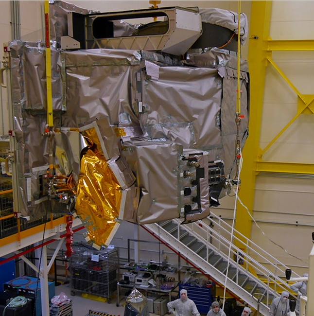
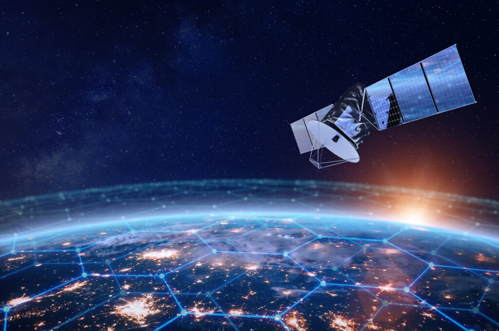
Supporting The GeoXO Program's Mission With Data-Driven Insight
GeoThinkTank LLC partnered with NOAA’s GeoXO Program to accelerate the development of next-generation U.S. geostationary environmental satellite capabilities. Our work bridged the gap between complex engineering requirements, scientific objectives, and end-user needs through rigorous modeling, analysis, and technical consulting. We delivered end-to-end instrument performance simulations—from engineering specifications to final data products—enabling informed trade-off analyses and objective-driven decision support. Our contributions included focused trade studies, calibration and validation (cal/val) strategies, end-to-end image chain analyses, and the development of comprehensive science traceability matrices. These efforts empowered stakeholders to make evidence-based decisions with confidence, ensuring the alignment of future systems with national environmental monitoring goals. Summary Value:
- End-to-end instrument modeling and simulation to evaluate performance impacts from design to data products.
- Data-driven trade studies enabling informed decisions across engineering and science priorities.
- Science traceability matrix development connecting satellite requirements to user outcomes.
- Comprehensive cal/val and image chain analysis ensuring system readiness and scientific integrity.
AI Speaker For
Real-World Innovation
We bring real-world AI insights to everyday innovation.
Environmental FAQs
What Types Of Environmental Data Do You Work With?
We work with a wide range of datasets, including weather, oceanographic, atmospheric, and satellite-derived data. Our systems are built to aggregate, process, and deliver insights from both public and private data sources.
Do You Build Custom Environmental Dashboards Or APIs?
Yes. We tailor data delivery to your needs—whether it’s a web dashboard, mobile app, or API integration into your existing tools.
How Accurate Are Your Predictive Models?
Our models are built using advanced AI/ML frameworks and are trained on historical and real-time datasets. Accuracy is regularly benchmarked and improved through continuous feedback loops.
Can Your Data Tools Be Used In Remote Or Offline Environments?
We design flexible solutions that support both online and field-based use cases, including offline data caching and mobile-friendly interfaces for remote teams.
Who Typically Uses Your Environmental Intelligence Platforms?
Our tools are used by federal agencies (like NOAA), researchers, commercial marine operators, environmental consultants, and mission planners who rely on real-time data to make informed decisions.
01. This is a frequently asked question?
Lorem ipsum dolor sit amet, consectetur adipiscing elit. Suspendisse varius enim in eros elementum tristique. Duis cursus, mi quis viverra ornare, eros dolor interdum nulla, ut commodo diam libero vitae erat.
02. This is a frequently asked question?
Lorem ipsum dolor sit amet, consectetur adipiscing elit. Suspendisse varius enim in eros elementum tristique. Duis cursus, mi quis viverra ornare, eros dolor interdum nulla, ut commodo diam libero vitae erat.
03. This is a frequently asked question?
Lorem ipsum dolor sit amet, consectetur adipiscing elit. Suspendisse varius enim in eros elementum tristique. Duis cursus, mi quis viverra ornare, eros dolor interdum nulla, ut commodo diam libero vitae erat.
04. This is a frequently asked question?
Lorem ipsum dolor sit amet, consectetur adipiscing elit. Suspendisse varius enim in eros elementum tristique. Duis cursus, mi quis viverra ornare, eros dolor interdum nulla, ut commodo diam libero vitae erat.
05. This is a frequently asked question?
Lorem ipsum dolor sit amet, consectetur adipiscing elit. Suspendisse varius enim in eros elementum tristique. Duis cursus, mi quis viverra ornare, eros dolor interdum nulla, ut commodo diam libero vitae erat.
Strategic Systems Consulting
We provide strategic technical consulting and science advisory. From early-stage planning to deployment, we help clients align system design with mission goals and operational needs.
- Technical strategy development and advisory
- Support for remote sensing, EO/IR, and AI systems
- Government and commercial consulting expertise
- Alignment of technology, policy, and execution
Imaging Science Advisory
Our imaging science experts help clients improve data quality, sensor accuracy, and imaging system performance. We provide technical guidance for research teams, system developers, and program managers.
- Radiometric imaging expertise
- Sensor selection, calibration, and tuning support
- Imaging workflow analysis and validation
- Trusted advisory for government and commercial projects


Technical Project Management
We manage high-complexity technical programs with precision and efficiency. Our leadership of the GOES-R Airborne Science Validation Campaign is just one example of our hands-on, mission-critical coordination.
- Program planning and execution
- Stakeholder coordination and reporting
- Budget, timeline, and risk management
- NASA/NOAA field campaign experience
AI/ML Research & Product Strategy
We help clients explore, design, and launch AI-driven solutions—blending deep technical research with commercial product thinking. From model development to user strategy, we bridge innovation with impact.
- Custom AI/ML model architecture
- Commercial and government use case analysis
- Research-to-product translation
- Strategic planning for scalable AI systems

Data & Workflow Optimization
We reprocess remote sensing data through precision calibration, cleaning, and transformation techniques—ensuring it’s mission-ready for scientific and operational use. Our frameworks streamline bottlenecks and boost processing efficiency.
- End-to-end workflow evaluation
- Data cleaning, calibration, and standardization
- Automation and efficiency consulting
- Field-tested for NASA and NOAA datasets
Commercial Product Development & Launch Strategy
We support the entire lifecycle of scientific or AI-based product development—from concept validation to launch.
- MVP strategy, design, and roadmap development
- Product-market fit and feature prioritization
- Launch planning and operations consulting
- Deep experience in geospatial and AI platforms


Innovation Roadmapping for Remote Sensing, Environmental, And AI Sectors
We help organizations define where to invest, innovate, and adapt. Through structured roadmapping sessions, we guide teams in aligning technology development with long-term mission and market goals.
- Stakeholder interviews and strategic planning
- Innovation assessment frameworks
- Opportunity mapping and gap analysis
- Focused on performance optimization
Geospatial & Remote Sensing Subject Matter Expertise
Our SMEs provide deep, on-demand knowledge for technical teams needing expert input in remote sensing, EO/IR systems, and geospatial analysis. We support R&D, proposal development, and complex project execution.
- Decades of EO/IR and remote sensing experience
- Informed by hands-on NASA/NOAA field work
- Rapid knowledge ramp-up and deliverables support
- Flexible consulting arrangements


Technical Support for RFPs & Government Proposals
We help clients craft compelling, technically sound proposals for federal contracts. Our team brings proven experience with to RFPs across aerospace, environmental, and data science domains.
- Proposal writing and review
- Technical narrative development
- Compliance with government submission standards
- Success with NASA, NOAA, and other federal agencies
Strategic Consulting for Data-Driven Success
We help organizations build better data strategies—combining technical precision with outcome-driven planning. Our consulting spans technical architecture, team design, and end-user delivery.
- Current-state data infrastructure assessment
- Strategic architecture planning
- Workflow and tooling recommendations
- Data use-case alignment with goals


Imaging Science End-to-End Advisory
From sensor development to data analytics, we provide full-spectrum advisory in imaging science. Our guidance ensures quality, innovation, and mission alignment at every stage.
- Sensor design and calibration oversight
- Image chain optimization and QA
- Algorithmic model tuning and evaluation
- Validation field campaigns and system assessment
Technical Project Management Excellence
We offer top-tier project management tailored to science and engineering programs. Our team delivers structure, visibility, and execution for high-stakes, high-complexity initiatives.
- Agile and milestone-based delivery frameworks
- Risk management and budget tracking
- Team coordination and accountability systems
- Science and mission-based schedule adherence


AI/ML Research & Product Strategy Innovation
We develop innovative strategies for AI/ML productization—from core model experimentation to deployment planning. Our approach connects model capability with user need.
- Discovery workshops and competitive analysis
- Model selection and proof-of-concept
- Strategic roadmap for internal and external deployment
- Responsible AI evaluation and data governance
Data Reprocessing & Workflow Optimization Solutions
We engineer solutions that accelerate data throughput and increase usability. Our services combine system optimization with user-centered workflow upgrades.
- High-efficiency pipeline design and build
- Mission level data reprocessing
- Automation and modernization
- Scalable solutions built for mission-critical use
How It Works
At GeoThinkTank, we blend deep technical expertise with strategic execution to deliver innovative solutions—from system design to mission-ready performance. Here’s how we bring your vision to life.
01.
Discovery & Requirements
We begin by understanding your mission objectives, system needs, and data challenges. Through collaborative discussions and technical assessments, we align on a clear scope and success criteria.
02.
System Design & Modeling
Our team develops custom architectures using advanced modeling and simulation techniques. Whether it’s EO/IR payloads or UAS platforms, we ensure systems are optimized for real-world performance and mission goals.
03.
Integration & Field Testing
From component-level integration to full system validation, we manage the end-to-end buildout. We conduct rigorous field testing and calibration—often in collaboration with agencies like NASA and NOAA—to ensure accuracy and reliability.
04.
Data Analysis & Optimization
After deployment, we analyze performance metrics and environmental data to refine and optimize system outputs. Our insights inform continuous improvement, mission planning, and long-term system resilience.
01.
Identify the Data Need
We start by understanding the specific environmental questions or operational challenges you’re facing—whether it’s for fieldwork planning, risk mitigation, or real-time decision support. This ensures our solutions are purpose-built for your mission.
02.
Configure Data Pipelines
Using our custom-built geospatial data engine, we design AI/ML-powered pipelines that pull from trusted weather, oceanic, and environmental data sources. These pipelines are tailored to your region, use case, and delivery preferences.
03.
Actionable Insights
We transform raw data into intuitive visualizations, alerts, or predictive models—delivered in the format that works best for your team. Whether mobile, dashboard, or API-driven, you get real-time intel when it matters most.
04.
Refine & Evolve
As conditions and priorities shift, we iterate. Our system continuously adapts through feedback loops, user behavior, and model performance to keep insights relevant, accurate, and impactful.
01.
Strategic Intake & Assessment
We begin with a focused consultation to understand your goals, challenges, and current systems. Whether you’re launching a new mission or optimizing an existing program, we align our approach with your priorities.
02.
Expert-Led Solution Design
Our team applies deep subject matter expertise across imaging science, systems engineering, and geospatial analysis to craft tailored solutions. We combine technical precision with strategic foresight to solve complex problems efficiently.
03.
Implementation & Support
From high-level strategy to hands-on execution, we support integration, testing, and project management every step of the way. We become an extension of your team, delivering with the same level of ownership and urgency.
04.
Insight & Optimization
We don’t just deliver reports—we provide actionable insights that evolve with your mission. Our ongoing support ensures sustained performance, informed decision-making, and long-term success.
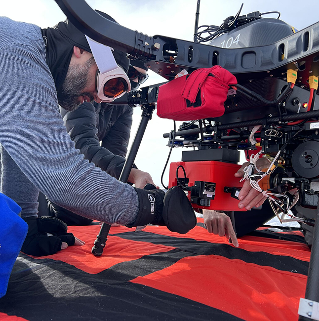
Stratospheric Satellite Validation
GeoThinkTank supported a critical airborne science campaign aimed at validating the performance of next-generation satellite instruments, including the Geostationary Lightning Mapper (GLM). By coordinating high-altitude flights from Warner Robins Air Force Base and executing detailed mission planning over Huntsville, AL, the team achieved independent calibration of satellite data using well-characterized aircraft sensors. This allowed for precise alignment between airborne and satellite perspectives—improving confidence in environmental data used for forecasting, public safety, and research.
AI Speaker For
Real-World Innovation
We bring real-world AI insights to everyday innovation.
Consulting FAQs
Whether you’re seeking strategic guidance, technical leadership, or proposal support, our consulting services are built to meet mission-critical demands. Here’s what clients often ask before getting started.
Can You Help With Government RFPs And Technical Proposal Writing?
Yes—we can assist clients in developing technically sound, compelling proposals for government contracts.
What Makes Your Consulting Different From Larger Firms?
We combine deep subject matter expertise with a nimble, collaborative approach. Clients work directly with seasoned experts who’ve led real missions—not layers of middle management.
Do You Offer AI/ML Strategy Or Product Guidance?
We’re actively developing AI/ML solutions in-house and building strategic expertise in these areas. While we’re not offering formal consulting yet, we’re always open to collaborating with organizations exploring similar challenges and would be glad to share insights or support where we can.
Can You Support One-Time Projects As Well As Ongoing Engagements?
Yes. We offer flexible consulting structures—whether you need a single technical deep-dive or long-term strategic support across multiple initiatives.
01. This is a frequently asked question?
Lorem ipsum dolor sit amet, consectetur adipiscing elit. Suspendisse varius enim in eros elementum tristique. Duis cursus, mi quis viverra ornare, eros dolor interdum nulla, ut commodo diam libero vitae erat.
02. This is a frequently asked question?
Lorem ipsum dolor sit amet, consectetur adipiscing elit. Suspendisse varius enim in eros elementum tristique. Duis cursus, mi quis viverra ornare, eros dolor interdum nulla, ut commodo diam libero vitae erat.
03. This is a frequently asked question?
Lorem ipsum dolor sit amet, consectetur adipiscing elit. Suspendisse varius enim in eros elementum tristique. Duis cursus, mi quis viverra ornare, eros dolor interdum nulla, ut commodo diam libero vitae erat.
04. This is a frequently asked question?
Lorem ipsum dolor sit amet, consectetur adipiscing elit. Suspendisse varius enim in eros elementum tristique. Duis cursus, mi quis viverra ornare, eros dolor interdum nulla, ut commodo diam libero vitae erat.
05. This is a frequently asked question?
Lorem ipsum dolor sit amet, consectetur adipiscing elit. Suspendisse varius enim in eros elementum tristique. Duis cursus, mi quis viverra ornare, eros dolor interdum nulla, ut commodo diam libero vitae erat.